Signal & image processing: Getting from analogic to digital
With over 100,000+ downloads per month, Scilab is the most open numerical analysis and simulation software on the market.
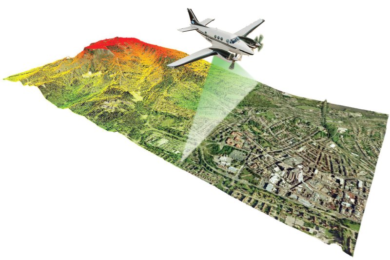
Automatic detection and characteristics extraction of archaeological structures
Since the last few years, archaeologists have the opportunity to use a very powerful tool in order to detect archaeological structures located in forest terrain: the airborne LiDAR.
The process presented uses the associated potentiality of Scilab and a Geographic Information System software.
Satellite data & spectrum plots
Cospas-Sarsat provides accurate, timely, and reliable distress alert and location data to help search and rescue (SAR) authorities assist persons in distress, using a satellite-based system. Alerts are provided world-wide and free of charge for the user in distress (aviation, maritime and land).
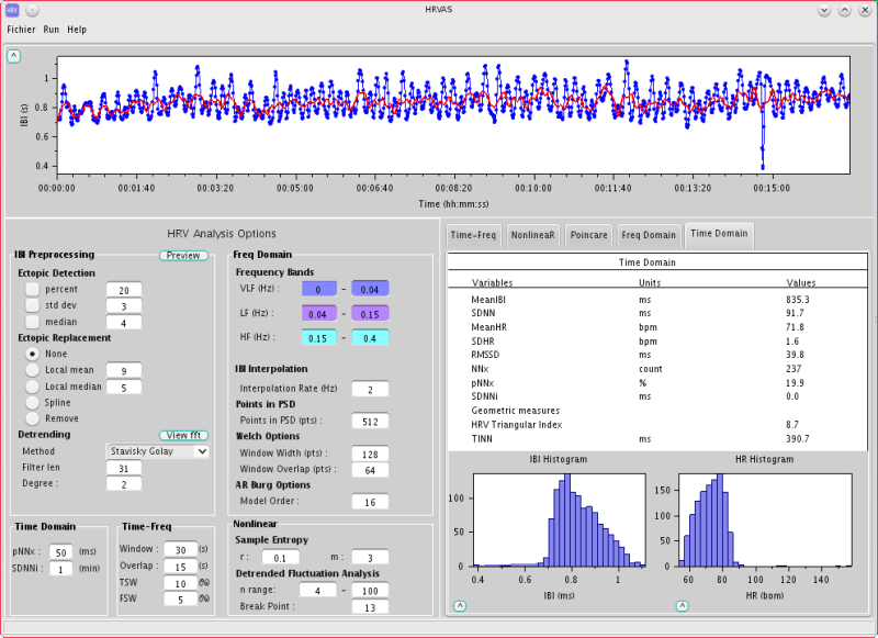
Cardiovascular wave analysis
This application is performing in 3 operations:
- Data acquisition
- Pre-processing
- Detection and Analysis